Thursday, November 20, 2008 - Foscue Creek Park, Demopolis AL
< previous day | archives | next day >

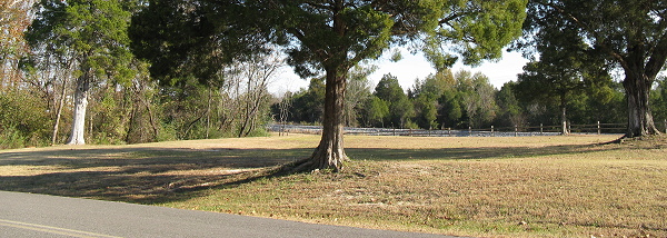
Tree - Foscue Creek Park, Nov 21, 2008
Well, I made it. Fifteen hundred miles south to Demopolis AL to escape the descending wintry weather in Red Rock. Right. It's as cold here tonight as it was when I left Red Rock a week ago. But that's ok; at least day time temps are a tad higher than those I left behind.
Once the current blustery spell passes I'll get down to business and see if I can find and seal the leaks that plagued me on those wet snowy miles on the way down.
Night camp
Site 45 - Foscue Creek Campground, Demopolis AL
- This is a well maintained US Army Corps of Engineers campground with level paved sites, most with full hookups
- Many sites overlook the water of the inlets off Demopolis Lake on the Tombigbee River
- There is good biking on the park roads
- The campground is pretty full Thanksgiving week and is generally booked solid the weekend of the Demopolis Christmas on the River festival in early December.
- Poor Verizon cell phone service - access is via Extended Network, roaming
- No Verizon EVDO service - access is via the Extended Network and service varies is slow but reliable
- Only 3 miles to Wal-Mart and other services in Demopolis AL
- Find other references to Foscue Creek
- List the nights I've camped here
- Check the weather
- Reserve a site
- Get a map
A Call to Nature
"About as far as from here to the station," went on Mr. Baca, "was a graveyard where the gang was supposed to camp out. I rode over to it and found where they had lunched the day before. There were {Begin deleted text}sardin{End deleted text} {Begin inserted text}{Begin handwritten}sardine{End handwritten}{End inserted text} cans and cracker boxes and one thing and another. Then I found where one of them had had a call to nature. I told one of my men to put it in a can. Saiz didn't know about this, and in a little while he went over behind some mesquite {Begin page no. 4}bushes and had a call to nature. After he came back I sent my man over, and by God it was the same stuff -- the same beans and red chili seeds! So I put Saiz under arrest and sent him back to the jail at Socorro with one of my deputies, although he kept saying he couldn't see what I was arresting him for."