Tuesday, January 20, 2009 - Oliver Lee Memorial State Park, Alamogordo NM
< previous day | archives | next day >

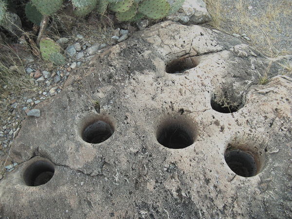
Indian wells, Oliver Lee Memorial State Park, Alamogordo NM, January 20, 2009
Indian wells
To quote the nearby interpretive sign:
Mortar Holes
These cylindrical mortar holes were used by prehistoric people who made frequent use of Dog Canyon. Mortars are often referred to as "Indian wells" because they collect rain water, but they were actually created as a result of food processing. Hand-held pestles were used to grind wild seeds and beans into flour, creating mortars in the bedrock over many years. A total of 39 mortars have been located in this area.
I'm getting antsy.
It's time to move on and I'll probably go over to Leasburg Dam State Park, Radium Springs NM, a few miles north of Las Cruces.
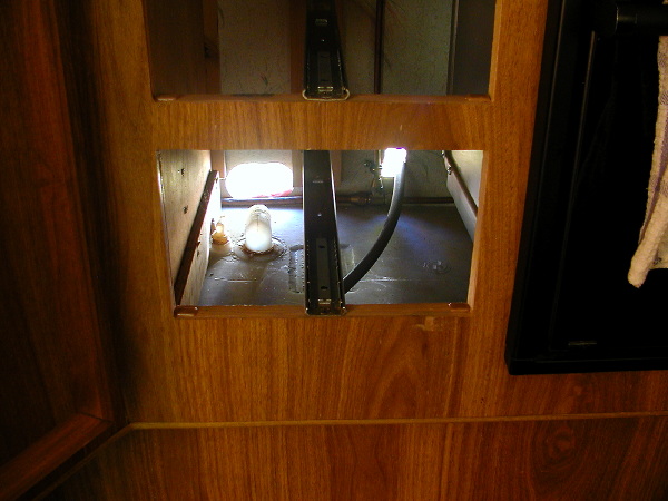
On the way over I would like to stop at a Home Depot to repair my leaking fresh water tank inlet hose. I replaced that hose back when I was repairing the big water leak damage and I had trouble getting the hose pushed onto the barb fitting at the elbow into the tank. The working conditions aren't great - it's behind a drawer under the kitchen counter - and I'm not entirely sure what I messed up so making the repair in their parking lot has the big advantage of my not having to pick up my mess and drive into town every time I come up a part short.

Water tank inlet, September 23, 2007
Night camp
Site 7 - Oliver Lee Memorial State Park, Alamogordo NM
- Verizon cell phone service - good signal
- Verizon EVDO service - very good signal and access speed ( I have to qualify this - during my January 2008 visit the signal and access speed was excellent - in January 2009 it was practically non-existent during the day and slow at night with unpredictable short periods of excellent access)
- Go to Oliver Lee Memorial State Park website
- Go to Oliver Lee Memorial State Park on my Nightcamps map
- Check the weather here
Ask What Surprised Them
I was afraid of flying for a long time and could only travel vicariously. When friends came back from faraway places, it wasn't just out of politeness that I asked what they saw. I really wanted to know. And I found the best way to get information out of them was to ask what surprised them. How was the place different from what they expected? This is an extremely useful question. You can ask it of the most unobservant people, and it will extract information they didn't even know they were recording.
The Age of the Essay, Paul Graham, September 2004